
Ushuaia wins over the traveler before they even land, when through the window the last stretch of the Andes appears, dropping toward the Beagle Channel. The southernmost city in the world has a direct beauty and the landscapes around it reinforce that idea from the very first moment.
Just a few minutes from downtown, which is only 11 kilometers away, Tierra del Fuego National Park, on the Argentine part of the island of Tierra del Fuego, concentrates much of that natural identity and protects a key subantarctic forest ecosystem with flora and fauna adapted to the conditions of the far south.
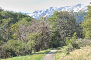
I chose to walk, and that changes the way the area is experienced. The trails force you to pay attention to the ground, which is usually wet from rain or snowmelt. The recommendation to wear waterproof clothing is not a minor detail because water is everywhere and even in the air itself, which turns colder when the wind comes down from the mountains.
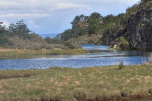
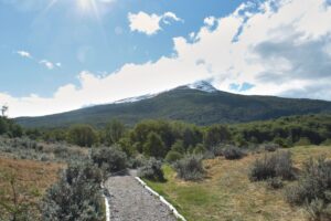
The forest is low and dense and is dominated by lenga and guindo trees that grow tilted by the wind. The view opens in some sections where you can see the outline of the mountains and understand that the park protects a glacial landscape. The wide valleys and the lakes that appear among the trees are the result of the retreat of the ice and work as natural resting points along the hike.
Walking in silence has its reward. Along several stretches of the trail, birds appear between the trunks, fresh tracks show in the mud, or a quick movement of an animal disappears into the forest and makes it clear that wildlife is present. That feeling is explained by the park’s policy, which only opens about 2,000 hectares to visitors out of a territory that exceeds 60,000, a limitation that translates into quiet trails and an environment where human presence does not dominate the landscape.
The weather changes quickly and within minutes the sky shifted from pale light to a fine drizzle that forced me to put on a jacket. It was not a problem but part of the experience because the forest becomes more intense in the rain. The ground, covered with mosses and ferns, holds the water and the air smells like wet wood. In spring, according to park rangers, the Magellanic orchid appears in some areas.
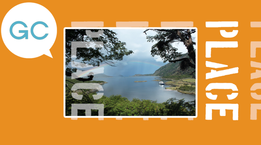
 One of the goals of the hike was to reach Lapataia Bay and the final stretch opens toward the coast of the Beagle Channel. The change in scenery is clear because the forest pulls back and a strip of water surrounded by low mountains appears. This is where National Route 3 ends and where many visitors gather after arriving on excursions or on the End of the World Train and catamarans. Even so the area maintains controlled use with wooden boardwalks that prevent soil erosion and mark the path.
Sitting in front of the bay, it becomes clear why the park was created to preserve the Patagonian Andean forest after logging had affected the area. The regeneration of the landscape is visible in the density of the woods and in the presence of waterfowl such as cauquenes and macá moving near the shore.
On the open slopes, birds can be seen riding the air currents and along the coast marine otters move among the kelp.
The park also preserves archaeological remains of the Yámana people and that information changes the way the territory is perceived. It is not only a natural space but a place that had human occupation for centuries and whose memory remains in specific sites that are marked and protected. That historical dimension coexists with the hiking experience and adds another layer of meaning beyond the landscape.
I made the return trip as the afternoon was fading. Walking in Tierra del Fuego means accepting a slower pace, stopping to avoid flooded sections and adapting to an unstable climate. Every stretch offers details that are lost if you move too fast.
Leaving the park and returning to Ushuaia on the same day creates an obvious contrast. In just a few minutes, houses, the port and calm urban movement reappear, but the perception of time changes after several hours of walking in a forest where the dominant sound is wind and water.
That proximity is part of the park’s uniqueness because it allows access to a protected environment without long travel and at the same time maintains a sense of isolation that is uncommon in other destinations.
 The experience of hiking in Tierra del Fuego is one of a succession of small scenes that shape the journey. The value lies in ecosystem conservation, in the presence of wildlife, in the history that runs through the territory and in the decision to limit tourism in order to maintain balance. Walking there is a direct way to understand how a protected area works in the far south and why that model allowed the recovery of a forest that was at risk prior to 1960.
At the end of the day, the feeling is not of having checked off a list of sights but of having crossed a landscape that demands attention and respect. Tierra del Fuego stands out as the end of a road and, at the same time, the beginning of a natural system sustained by a long-term conservation policy.
That combination explains why the park remains one of the most sought-after experiences in Ushuaia for those who prefer to walk – and read the territory step by step.
Images: Edgary Rodriguez R.